Maps can help you plan a road trip, explore new places, or even find buried treasure. But there’s another kind of map that can help chart the path to a more sustainable future and unlock the potential for wind energy development. The National Renewable Energy Laboratory (NREL), together with the Energy Department’s Wind Program and AWS Truepower, has released maps that illustrate the potential for wind energy development using new wind turbine technologies.
Wind industry professionals use wind resource maps in the early stages of wind farm project planning to understand the potential for wind development in a particular region and to see where more in-depth site evaluation might be justified for various types of turbines.
The Energy Department previously released maps that gauge average wind speeds at 80 and 100 meters (262 and 328 feet) above the ground. The new maps released by NREL build on these wind speed data to identify areas throughout the country that have an average wind energy capacity factor greater than 35 percent. (Wind energy capacity factor is a measure of power plant productivity that indicates how much electricity a wind farm actually produces relative to the maximum it could potentially produce at continuous full-power operation over a specific time period.)
These new maps also show the concentration of land areas with capacity factors over 35 percent at higher turbine hub heights of 110 and 140 meters (361 and 459 feet), representing recent and planned turbine advancements, respectively.
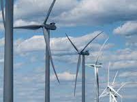
Since stronger and more consistent winds are typically found at higher heights, the Energy Department has been working with the wind industry to produce the next generation of taller wind turbines that reach higher hub heights (the height of the nacelle mounted atop a turbine tower). The Energy Department estimates that enabling cost-effective deployment of wind turbines with hub heights up to 140 meters will unlock an additional 1,800 gigawatts in wind power resource potential across 237,000 square miles of the United States.
Technological advancements are also leading to more efficient wind turbines with longer blades, allowing them to generate more electricity out of the same amount of wind. With these advancements, areas with limited wind resources at lower heights–such as the southeastern United States–now have the opportunity to add new wind power capacity using utility-scale wind energy technologies. All of these advancements also help reduce the cost of clean, renewable energy for consumers across the country.
The Energy Department’s Wind Program and industry partners have made great strides in increasing the performance and reliability of next-generation wind power technologies. The program’s research efforts in testing, manufacturing, and component development have helped increase the efficiency of turbines, generating even more clean energy from wind. As the Energy Department and industry continue to invest in improved wind turbine manufacturing and resource assessments, these new wind resource maps will serve as an important tool for future wind energy planning.
— U.S. Department of Energy; Office of Energy Efficiency and Renewable Energy – Wind and Water Power Technologies Office.


