


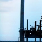
Geotechnical surveys physically sample or test the seabed characteristics so developers can ensure the optimal placement of offshore wind farm turbine, substation, and cabling infrastructure. By the time a project requires geotechnical data it has already traversed several stages, including desktop, baseline, environmental, marine mammal observation, hydrographic, and geophysical studies, so stakeholders have significant investments tied up in their leaseholds. As the tasks that comprise geotechnical studies represent the largest single investment in the site characterization process, they require extensive experience in marine operations and equipment, particularly as projects move from the shallow-water regions that comprise the bulk of offshore farms around the world to increasingly deeper waters.
Though marine wind projects in North America are moving forward, the United States still doesn’t have a production turbine in the water and has yet to institute a federal Renewable Energy Standard (RES) or the long-term production tax credits that will encourage the level of investment needed to drive the sector. On the regulatory front, BOEM and other agency regulations are works in progress, but agencies have stated their intentions to collaborate and use existing multidiscipline data to streamline permitting guidelines where applicable. When these financial and regulatory issues are eventually addressed, the U.S. will need to play catch-up.
The good news is that U.S. developers can turn to offshore geotechnical work in Europe and elsewhere to inform their own wind energy efforts. To speed the tempo needed to stay competitive on an international scale and reap the economic and environmental benefits that offshore wind promises, North American contractors can incorporate the hard-won lessons learned collecting geotechnical data for overseas offshore wind projects, as well as from oil and gas projects worldwide. The offshore O&G industry has spent decades incrementally improving geotechnical techniques to develop optimum specifications and equipment, which have been further tested and modified over the last several years for offshore wind installations off Europe. Though the vast majority of wind projects has thus far been in shallower waters, deepwater O&G specs and continuing lessons from overseas wind farm work can serve as very valuable tools for projects progressing off the East Coast, in the Great Lakes, and in the Gulf of Mexico.
These synergies were a key driver behind United Kingdom-based Gardline Ltd.’s acquisition of New Jersey-based Alpine Ocean Seismic Survey in 2009. Working in the offshore wind sector for more than a decade, Gardline has completed more than 140 renewables projects and is currently involved with five of the U.K.’s nine Round Three efforts. Alpine, working alongside Gardline Geosciences, adds the complex geotechnical piece to its existing portfolio of marine services to offer one-stop, turnkey data collection solutions for North America’s burgeoning offshore wind sector, giving the company access to the kind of equipment and experience needed to tackle geotechnical work in nearshore, transitional depths, and deepwater projects. With expertise gained from more than 50 years in marine projects, Alpine brings localized knowledge of the U.S. market and regulations, long-standing associations with state and federal agencies, and relationships with other domestic contractors that simplify project coordination.
Geophysical Informs Geotechnical
The efficiency and quality of a geotechnical campaign is closely tied to the success of the geophysical data collection operation that precedes it. The high-resolution geophysical (HRG) studies that acoustically map seabed features—seafloor topography, bathymetry, stratigraphy, archaeological elements, hazards, and other characteristics—enable the design of a geotechnical study that targets locations that will yield the most representative physical samples and in-situ measurements needed to determine the viability of proposed infrastructure sites. Geotechnical studies examine soil structure and other attributes that, combined with geophysical findings, create the geological model needed to establish engineering parameters for turbine foundations, substations, cable burial trenches, and other infrastructure.
According to estimates, geophysical, geological, and geotechnical studies comprise on average more than three quarters of the total cost of site characterization investigations. With comprehensive geophysical data gathered and analyzed, geotechnical contractors can—where regulations allow—reduce the number of points that have to be physically sampled or drilled, thereby trimming the cost and time of their effort. Further, with a single experienced marine contractor handling both disciplines, developers can alleviate concerns that a geotechnical outfit working independently of the geophysical provider will perform unnecessary work. Beyond getting a geotechnical design that best complements the geophysical data collected, stakeholders also ensure they get smooth transitions between survey phases, accountability, and a single point of coordination, keeping costs and timelines more reasonable than those sometimes seen when multiple contractors are involved (Figure 1).
In the U.K., for example, offshore wind farm regulations allow contractors to rely more on less-costly geophysical surveys to target optimum—rather than overly redundant—test sites for their geotechnical studies. U.K. guidelines regulating geotechnical designs are geology- and consultant-dependent, an approach that can streamline the extensive amount of work required. Based on their geophysical data analysis, for example, North Sea contractors can reduce the number of conventional soil boring samples they take by relying more heavily on seabed cone penetration testing (CPT), which can be less expensive and provide better coverage than conventional drilling. As agencies elsewhere see satisfactory outcomes from an approach that gives more credence to comprehensive geophysical campaigns, they’re more likely to consolidate their own regulations to more efficiently get critical infrastructure in the water and operational.
In the U.S., BOEM guidelines currently require CPT and soil borings for each turbine foundation pile and substation. However, as projects progress around the world, geosciences contractors may be able to leverage successful outcomes from overseas efforts to work with BOEM to ease regulations as agencies have in the U.K. With such evidence, BOEM may deem its blanket regulations for this kind of activity to be excessive, and allow U.S. contractors to leverage vetted geophysical data to reduce the number of locations where they must supplement CPT with standard soil borings. In the mid-Atlantic region of the East Coast’s Outer Continental Shelf (OCS), for example, the geology generally isn’t highly varied, which can obviate the need to conduct conventional borings in every location, reducing survey time, costs, and permitting cycles.
Equipment Selection Suits the Project
The equipment used for a marine geotechnical campaign depends on water depths and ground conditions, as well as the region’s regulatory requirements, making ready access to a depth and breadth of tools that span a wide range of project types a key differentiator. Geotechnical specialists should be capable of deploying the following technologies:
Cone penetration testing (CPT) units: CPTs are versatile devices used for in-situ soil tests, typically the first step in a geotechnical campaign. CPTs capture data continuously or at specified depths on such geotechnical parameters as soil density, shear strength, and consolidation rates. During penetration, the forces on the cone and the unit’s friction sleeve and pore pressure transducers are measured and transmitted to topside data-logging software. For work in North American waters, contractors should be able to choose from a number of units designed for specific applications and penetration depths, ranging from lightweight mini-CPTs (with penetration up to 10m) to such equipment as Wheeldrive ROSON units (with penetrations up to 40m), Neptune 3000 and 5000 units (10m and 20m, respectively), and wireline CPTs, which enable downhole tests to be performed and guarantee CPT data to the final depth of the borehole.
CPTs provide more accurate, calibrated, and fully traceable in-situ information on the geotechnical properties of the soil than standard penetration tests (SPTs), which are more commonly used for land projects and involve counting how many blows (blow counts) of a standardized weight it takes the drill string to penetrate a set distance. Data captured through CPTs can be analyzed onboard in realtime, unlike physical samples that require offshore or onshore laboratory testing.
Seabed samplers: For seabed sampling for such infrastructure studies as cable route surveys, geotechnical contractors utilize a range of samplers. A provider should have at its disposal:
• High-power and specialty vibrocorers;
• Hydraulic clamshell grabs for bulk samples;
• Box corers for minimal impact sampling of surface soils.
Heave compensation drill rigs: For deeper-water wind farm projects, geotechnical data acquisition requires the use of heave compensated drilling rigs. These systems provide three-meter heave compensation, allowing drilling to continue undisturbed in rougher marine conditions where waves that lift the drilling vessel likewise raise a stationary drill, potentially ruining the sample or damaging the rig. They can be permanently installed on dedicated drill vessels, and are also available in containerized packages so they can be used on third-party vessels, where ideally, they are operated through a moon pool, or if necessary, through side-mount installation.
For offshore renewables projects, heave compensation rigs should be capable of drilling in water depths up to 1,000 meters, enabling them to be deployed for drilling, sampling, and downhole CPT efforts for a range of wind farm sites. These systems can also perform downhole geophysics studies—performed in completed boreholes to calculate additional important attributes related to depth—and can incorporate onboard data and analysis capabilities. For leaseholds in deeper waters, developers should consider contractors with these rigs in their arsenal, ensuring the extensive experience required to deploy them for various applications.
Vessel Versatility
As the majority of the wind farm work in the North Sea and in U.S. waters to date has been nearshore, geotechnical contractors have relied to a great extent on smaller niche and jack-up vessels, often opting to mount land-based truck-mounted rigs for drilling purposes. Under the right conditions and supervision, this combination is effective and cost-efficient, but it is limited in application.
On the vessel side, jack-ups revealed their limitations for wind farm geotechnical site investigations in early North Sea efforts. Testing for wind turbine sites naturally means working in windy areas, and unlike specialized vessels, stationary platforms aren’t optimized to handle the resulting marine conditions. Further, research teams with stationary jack-ups can only test in the area within range of the vessel before mobilizing to a new location, a more arduous process with jack-ups than in moving a dynamic positioning (DP) or anchored vessel. This remobilization process doesn’t easily accommodate the need to work in the tight timeframes when weather conditions are suitable, a leading factor dictating offshore data collection. In addition, smaller jack-ups don’t have adequate living accommodations, so personnel must be continually transported from ship to shore and back.
On the equipment side of the equation, there are also HSE (health, safety, and environment) issues to consider when using land-based drilling equipment on jack-ups. Relatively few drilling operators whose expertise is in land-based projects have the experience required to conduct drilling safely, effectively, and efficiently offshore. Further, the effectiveness of this vessel/drill rig combination is limited to shallower waters under calm conditions. For projects farther offshore, contractors must rely on marine options designed for harsher conditions, both for effective operations and safety reasons. Expertise in these challenging environments is important as projects progress in the Northeast, where most of the geotechnical drilling to date has been on inland waterways rather than offshore, where conditions are far less predictable.
In deeper waters, a heave compensated rig is the superior drill choice. The point where contractors should consider moving to this kind of rig is when water depths reach 60 to 70 feet. Some jack-ups, especially those available on the East Coast of the U.S., aren’t large enough to perform safely or adequately beyond these depths. Although larger jack-ups working in the Gulf of Mexico can operate in deeper waters, the costs of mobilization from the Gulf to the Northeast, coupled with the higher costs of leasing a bigger vessel, make it more effective and equally economical to use heave compensation equipment on a properly configured drill ship.
Though the bulk of U.S. offshore wind development to date has largely been in water depths ranging from less than 60 to around 160 feet, it’s just a matter of time before efforts move to deeper areas. If developers are planning a small test turbine array in shallow water, heave compensated equipment isn’t necessary, but if they’re intending to place hundreds of turbines in deeper waters, it’s much more effective to choose a heave compensated system mounted on a dedicated DP vessel to take advantage of strong seakeeping performance, onboard real-time data analysis capabilities, dry and wet laboratories for sample processing, and accommodations for extended periods at sea.
Depending on project parameters, heave compensated drilling rigs can be permanently mounted on specialized vessels or temporarily installed on multi-role vessels and barges. In the U.S. it’s important for both project suitability and local stakeholder interests—given the strong business emphasis on using local providers—that companies have geotechnical equipment that can be mounted on third-party barges and other vessels to employ local companies as part of a project.
When developers contract with a geotechnical services provider whose expertise is in offshore operations, they ensure they get personnel with experience sampling and drilling in a dynamic marine environment, who understand the risks, safety requirements, and specific data attributes needed to design and conduct acquisition efforts. With this approach, even if the project is far-reaching and calls for using land-based equipment on jack-ups nearshore and marine-optimized technologies and DP vessels in deeper water, the marine contractor can coordinate the entire operation and ensure quality control throughout the project. The geotechnical campaign is consequently much more likely to be completed successfully without encountering the kinds of problems that can bring a project to a costly and damaging halt.


