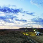
Repowering an existing wind site can be a daunting task. Typically, you will face one of two scenarios: In one scenario you will “repower” your aging wind turbines with newer, larger rotors and upgraded drive train components, generator, and converter systems using existing tower structure. For the other “typical” scenario, however, you are tasked with replacing legacy systems with new towers, nacelles, and components. Either way, you have a monumental undertaking ahead of you.
No worries! You contact the turbine manufacturer to see what options they provide for the upgrade to your turbine. Next, you check your schedule for the actual execution of the project — and you get bids from a couple of reputable construction providers. You create a project timeline and begin to set out a “critical path” for the execution of the project. You are almost ready to begin. What are you leaving out?
First of all, this may be an oversimplification of the repowering process facing owners today. To thoroughly evaluate the upgrades and investment required to repower wind-energy conversion systems (what turbines were called in the early days) — we must always go back to the questions and answers provided by accurate data of available wind resources.
So, how are you going to get the information on the available wind resources at the site for your project? Will you rely on existing met towers and extrapolate the data associated over a long-term sample, or will you need to develop a method of acquiring the much-needed data at the higher hub level? The importance of gathering and validating the variations in wind speed, shear, and turbulence intensity for a utility scale project are critical points of information that cannot be overemphasized.
There are a number of considerations that are factored into the evaluation of the wind resource at a prospective repower site. The following indicators are key for your WRA and will be important to the feasibility and success of the repowering project:
• Historical wind resource data: This collection may be gathered at a lower tower height (at 60 meters, for example) then extrapolated to consider the potential increases with larger rotor diameter and tower height.
• Flow modeling: Gain using mathematical and meteorological modeling to understand variations in wind resource due to complex terrain, changes in elevation, and wake interference for the prescribed larger rotors.
• Consideration of losses, including wake, system losses and availability, and turbine performance: There has been much discussion regarding wind shear and wind instability within the rotor sweep as opposed to a specific point as captured by a cup anemometer.
Three Distinct Possibilities
When it comes to an accurate WRA for your project, you will want to reduce as much risk as possible. Decreased power prices mandate that every resource is fully utilized. As the margins get tighter in power generation, the risks in your data points and WRA projection also need to be reduced.
It is possible to extrapolate the historical data for an existing site to provide projections at a higher hub level and with a larger rotor sweep. The correlated data from existing towers can provide a good basis for actual data at hub height but can provide only a projected forecast of WRA at the increased altitude and sweep.
It is also possible to get reliable data at the new tower hub level by installing taller meteorological towers at specified locations on the site. This is a common practice for initial siting and is also a popular option for tower repowering of sites. The current demand to complete assessment for Production Tax Credit (PTC) consideration may be creating significant lead times for permitting, construction, and execution in the installation of 100-meter (and higher) towers. In addition, there are increasing regulatory demands in certain locations that add to the overall scope and timelines for the installation of taller towers.
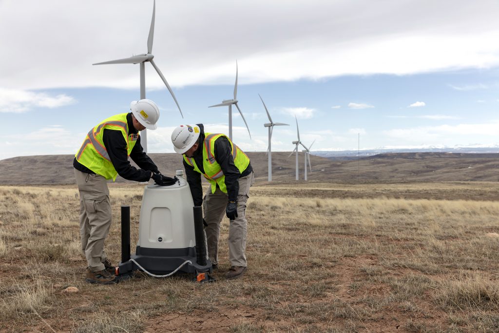
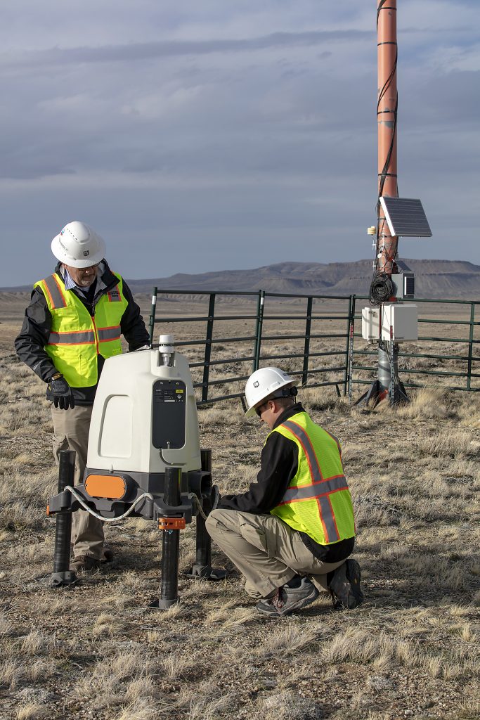
And finally, it is possible to get accurate WRA data through direct assessment that provides clear and traceable wind resource and performance data through remote sensing devices. These remote sensing devices (RSD) are portable, do not require permitting, and have a very small footprint. Many of the options for RSD also come with impressive performance credentials and are proving to be a reputable option for rapid deployment and reliable data. Evidence of the improved reputation of RSD was demonstrated in June 2018. An important recognition for vertical profiling lidar was provided where vertical profiling lidars achieved levels of IEC 61400-12-1: 2017 Ed. 2 classification. This recognition provides wind-industry professionals greater confidence and reduces the risk of data uncertainties in WRA, turbine power performance, and other operational needs.
Why Should You Consider Remote Sensing?
There are many reasons to consider remote sensing for a repower project, including portability, the risk avoidance of working at heights, the ease of installation (permitting and conditional use permits are not required), and the robust performance of a RSD. One of the most important aspects is the ability to take and record accurate data at different locations without scheduling a mobilization/decommissioning team, completing a lengthy permitting process, and dealing with the risk of working at height or exposure to extreme weather conditions. Remote sensing allows you the flexibility that may be demanded of you.
Turn Key Remote Sensing Services
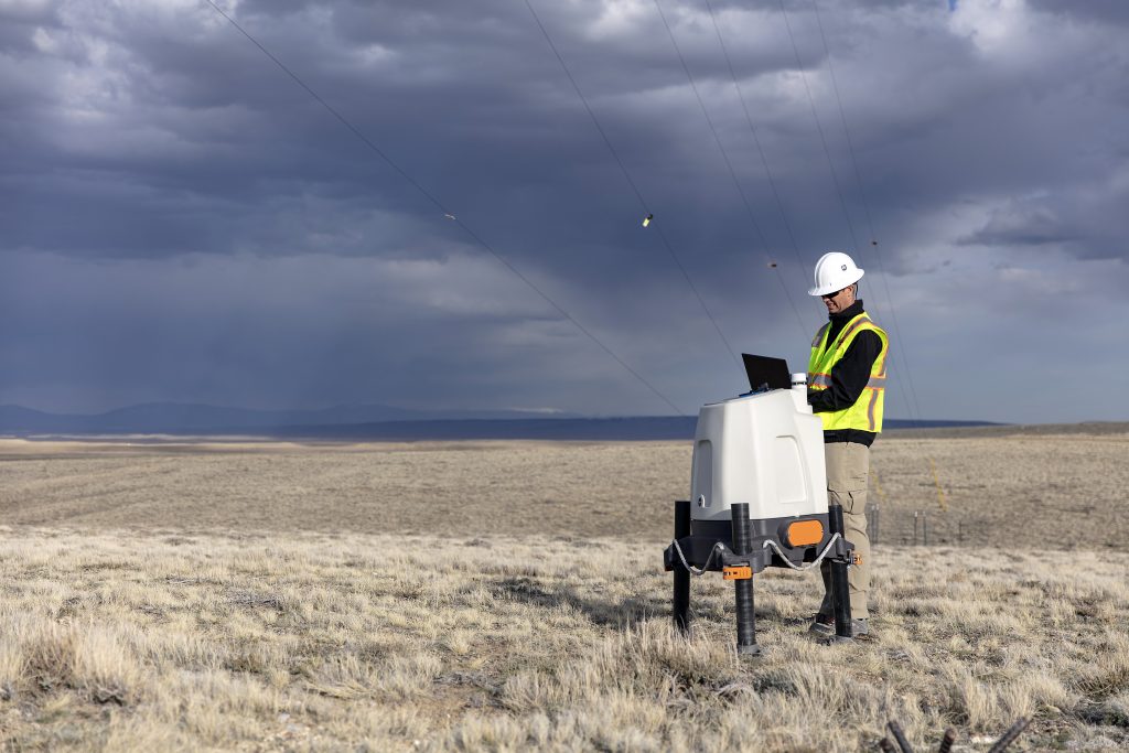
The flexibility of a RSD is one of the keynotes for a worry-free, turn key solution. A remote sensing device can easily be deployed in the field with two people and a vehicle. Considerations for power may involve a secondary power supply, but if you have power to the tower (met or wind turbine) you may be set. Remote sensing solutions and services from companies such as Campbell Scientific, enable wind-energy stakeholders to obtain key wind resource data from a wide variety of locations without the worry of permitting, equipment ownership, maintenance, commissioning, or decommissioning. Units can be set up and deployed in a matter of hours, and – if extreme weather is on the horizon, the units can be retrieved and stored until the “all clear” is sounded.
Remote sensing has been used and tested in a wide variety of applications internationally and domestically. Vetted recommendations of key wind-energy leaders and consultants provide a proven track record for this method of WRA for numerous projects.
A robust remote sensing service can deliver valuable data without the worry — increasing the quality of your data, while reducing the cost and risk. A stable and reputable company will be able to customize the service level that best meets your requirements.
Reliable data at a variety of heights
Remote sensing devices allow you the ability to program and select specific heights for your wind-data collection. The ZephIR Lidar provides the ability to select and program up to 10 different heights (10 to 300 meters) to capture wind speed, direction, and shear. Using a continuous beam at 50 sweeps per second, it provides a reference across the entire rotor with this key data available through a dashboard application without a post processing compiler.
In addition, with a robust remote sensing device, you can have finance-grade data in non-complex and complex terrain, proven performance verification at (IEC compliant) at your site.
Advanced flow models provide significantly improved horizontal and vertical extrapolation of measured wind resources, especially in complex and forested terrain. Flow-model accuracy is improved through the use of multiple spatially separated measurement points on the site for model verification and tuning.
Remote sensing devices (RSD) can provide the ability to define and track measurements at multiple points even for complex terrain. Remote sensors are re-useable, portable, and do not require lengthy planning before installation.
Data can be collected easily at multiple points on a site to provide representative measured data for all turbine locations and tuning verification points for flow models.
Recognized Reliability and Technical Advances
Remote sensing devices have improved greatly. Key partnerships have developed that add value to the experience of the end user. The combined experience of manufacturers and key companies have allowed even greater opportunity for the customer.
ZephIR and Campbell Scientific provide an example of strategic partnerships that benefit the customer and add value to remote sensing needs. The robust platform and excellent service create a number of possible applications for remote sensing services. From tower repowering to turbine power performance testing; meteorological mast validation to real time monitoring during crane operations, remote sensing services can give you the confidence in your data that will maximize your potential.
Key Considerations for Remote Sensing Services Options
Rental: Renting lidar/sodar units provides a flexible solution for gathering measurement data without a large up-front capital investment, the scheduling headache, and possible permitting nightmare. Long-term and short-term rentals are available (three to 12 months or beyond).
Deployment and Commissioning: Proper deployment is key to the overall data quality of your measurement campaign. Make sure your installers pay attention to detail — small details make the difference. Power, communications, and operational integrity are considerations that you would want to get right the first time. A full commissioning report should be provided. Remember the phrase — “test it before you trust it.”
• Full-Service & Data Delivery: Having the ability to respond to a customer’s technical needs is something that you will want to factor as you consider remote sensing. Can service be provided through a certified repair shop? Having the ability to respond to the field within a few days can be vitally important in your campaign. If service is required, a centralized base for operation and service is equally critical to your project.
• Your data is relevant, and should be available to your team: The ability to view the status of your unit, current wind speed readings, and download your data sets freely can make the decision basis more effective. The flexibility of real time data allows you full access to your data at the click of a button, there is no need for post processing of your key data points.
• Relocation: Again, one of the keys of remote sensing is the ability to relocate your station on short notice and with relative ease. The ability to move your remote sensing device to a string of towers that are being repowered can give you a unique ability to verify tower details (power performance, yaw alignment, met mast data) before the commissioning team leaves that string. Again, a single remote sensing unit, with an adequate cone angle, should be able to provide the resolution required for a specific number of towers in a string.
• Decommissioning: Once your campaign is complete, you will be sure that all equipment is decommissioned and removed safely and efficiently. You will have returned the site to its natural state, free to move to the next location.
The key advances in remote sensing devices such as lidar and sodar have created many new possibilities in siting, design, validation, and operation of onshore wind farms. Project owners and developers would be wise to employ careful consideration when determining which vendor, technology, and platforms for repowering or operational needs. The task may be monumental, but it is absolutely achievable during the changing seasons in our industry.