


Being able to monitor constantly changing weather patterns will be a crucial element of constructing and maintaining offshore wind farms in the U.S. To that end, GeoThinkTank LLC has developed an app that could be an important tool for the wind industry. Wind Systems recently talked with GeoThinkTank LLC’s owner and CEO Francis Padula about his company’s app, Nautical Eye, and how it is able to gather and disseminate weather data, forecasts, and more in real time.
What is GeoThinkTank LLC, and what is your role there?
I’m the owner and CEO of GeoThinkTank LLC. It’s a technology company located in Washington, D.C. We’ve been in business for over seven years, providing imaging science and geospatial consulting support to U.S. government customers that include NASA Goddard, NOAA NESDIS, and NOAA fisheries. I created the company with the mission of bringing sensors to life and Nautical Eye’s our first commercial product.
What is Nautical Eye, and what inspired this creation?
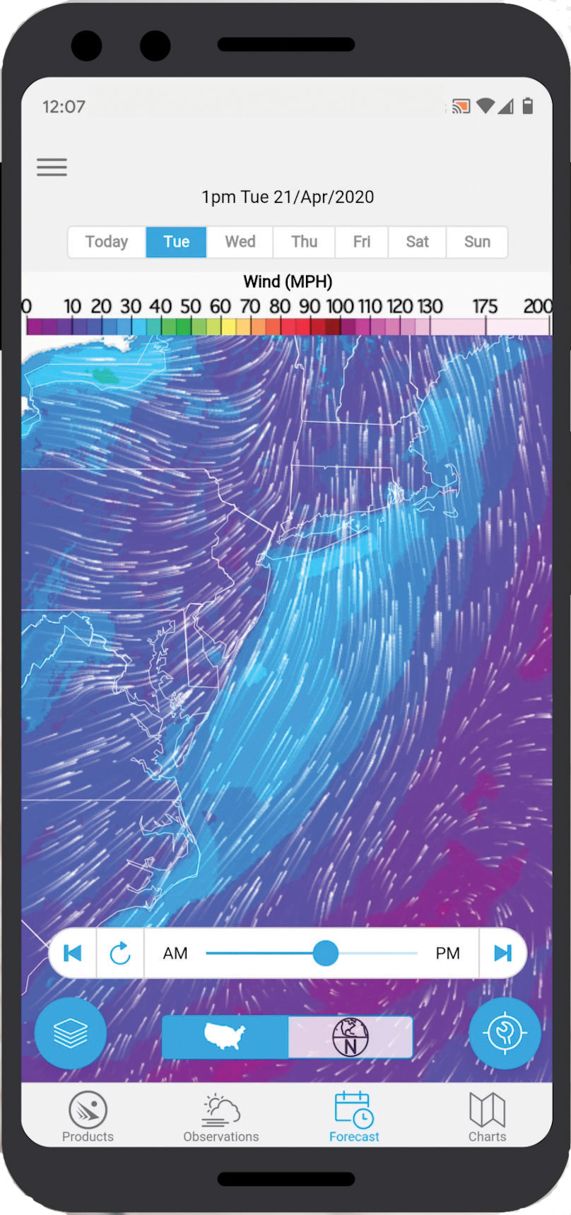
Nautical Eye is environmental intelligence. It’s a mobile app for maritime and land applications that provides users with a time-sensitive, comprehensive picture of their environment to inform and aid their decision-making.
We wanted Nautical Eye to help foster a connection to our blue planet in hope that it inspires a greater appreciation, respect, and a passion to explore, enjoy, and protect it. In short, weather is a fundamental component of our lives, and providing easy access to information enables decision-making and safety.
How does Nautical Eye work? How does it go about doing what you just said it does?
Nautical Eye delivers data on demand from our state-of-the-art environmental geospatial data services. We have a free version of the app, and then a pro version with a subscription on a monthly basis for $9.99 a month or $99 for the year.
In the app, there’s essentially four main components: There’s a products page, which gives you point weather access for both land and offshore U.S. waters and territories that provides wind, weather, wave information, tides, special weather statements, text forecasts, zone forecasts, and more. We also provide custom satellite products such as water surface temperature, ocean color, and water turbidity. All that information is dynamically changing as the satellites provide it.
Then you have observations that provide information from instruments, information collected of what’s happening now from buoys, tide stations, and weather stations to real-time weather radar and satellite imagery, which is updated every five minutes. We also have location-based satellite lightning notifications that notify users of when lightning has been observed in their area. We also have a forecast page, which gives users a graphical representation of a forecast, nautical charts, and more.
So, it’s a comprehensive suite of data that helps people make informed decisions.
What makes Nautical Eye an important tool for the offshore wind industry?
Nautical Eye provides on-demand weather and environmental data that gives businesses information to support operations, planning, and the safety of their employees all in one easy-to-use app.
For whatever the application, we provide layers of information. There are no absolutes in weather forecasting, so Nautical Eye enables users to layer information to enhance their situational awareness. If you’re a diver and you want to get in the water, you understand water quality, water temperature, wind, waves, etc. Whether you’re transporting personnel or you’re on the platform, you may be interested in fog, waves, winds, and the challenges that may be ahead. Or if you’re at the port; you have information that, again, is accessible to not just the decision makers, but to everyone across your enterprise.
How do you see Nautical Eye becoming an integral part of offshore wind?
I see Nautical Eye becoming an integral part of offshore wind by companies adopting and providing their employees access to the app to help inform their business operations, planning, and keep their employees safe with our environmental intelligence.
What’s your next step in getting Nautical Eye to these types of companies?
The app is available on the Apple app store and Google Play app store. This is our first conversation with the wind sector, and we’re excited to further this discussion and see where it goes. We’re even open to tailoring to see if there are other products that will better serve the industry.
Many wind companies already rely on ways to obtain weather data, so what makes Nautical Eye unique in this respect?
It’s the access to a suite of environmental intelligence products, all in one app — it’s just access. One of the most fundamental elements of data is having easy access to it.
That is the driver. Now, one thing to note is that Nautical Eye is powered by a custom data engine that was built solely to feed the app (meaning only Nautical Eye users have access to our data engine). Essentially, we built a custom data engine to aggregate data and get it out in a timely fashion, so we can make data access on-demand at your fingertips on a mobile device.
What would be involved in getting that access?
You can access all of Nautical Eye’s products by downloading the app on the Apple app store or Google Play app store.
Are you just looking to have this application be used for offshore wind in the U.S.? Or do you see it as a global application?
Right now, we’re focused on only the U.S. as we’re mirroring the National Weather Service forecast domains. But as we grow and see interest, we do intend to explore expanding our coverage.
You talked about Nautical Eye being used for offshore wind developments, but you also mentioned the app’s ability to monitor lightning, which is often a big challenge for wind turbines. In that respect, do you see Nautical Eye being used in an onshore capacity?
Absolutely. There is a lot of information out there regarding weather, but redundancy is key when you talk operations, and introducing new products can really be the difference. For example, the U.S. just launched a series of new weather satellites in geostationary orbit. As part of that mission, there’s the geostationary lightning mapper.
We’ve integrated that data into our data engine and enabled our users to get text-based notifications of when lightning is observed by satellite based on their location and proximity to the lightning (updated every five minutes). So, the big difference here with the ground lightning systems is that you get to really understand the spatial extent of lightning, and we think that can really help keep people informed and safe with information delivered right to their mobile devices.
Anything else you’d like to mention about Nautical Eye that might be advantageous to wind that you haven’t discussed?
In terms of everyday operations, I think both on land and offshore are especially important. Like any service, it does require you to have some way to communicate with the internet. On land, it is very easy to use. As you go offshore, you’re going to need a satellite link or some other source to get your on-demand real-time information. But the important thing is that, Nautical Eye provides the opportunity for everyone to have access to the same information across your enterprise, and I think that can be really helpful for business operations, planning, and safety.
More info www.nauticaleye.com


