Leading wind Lidar developer, ZX Lidars, has successfully demonstrated the use of Drone Wind Lidar to accurately measure the wind in what is believed to be a world-first.
ZX Lidars provides vertical and horizontal profiling wind Lidars to accurately measure wind conditions remotely and above or ahead of their installed position. These accurate, independent wind measurements are a cornerstone in the development, construction, and operation of wind farms globally.
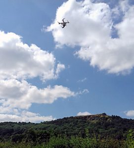
The company has now achieved accurate wind Lidar measurements from a commercially available drone (an unmanned aerial vehicle) for demonstration purposes and trialed the system successfully during summer 2018 with excellent data rates and sensitivity.
“ZX Lidars is a pioneer of wind Lidar technology — we were the first on turbines, the first offshore … now we’re the first to fly on a small drone,” SAID ZX Lidars’ Managing Director Ian Locker. “This and other trials conducted since 2015 only stand to further confirm that our core technology is accurate, reliable, and robust lending itself perfectly to a range of applications such as Drone Wind Lidar.”
Dr. Michael Harris, director of Science at ZX Lidars, has pioneered wind Lidar for the wind-energy industry for nearly 20 years and has been the driving force behind this latest innovation.
A number of ZX Lidar systems are available for trialing in this or similar applications.
2018 Drone Wind Lidar trial results will be presented at the Wind Energy Science Conference (WESC) 2019.


