


Whether an offshore wind-farm site is being considered for construction or a site is in full operation generating power, the need to monitor and collect data is crucial.
Specialized sail-powered drones designed and operated by Saildrone are turning that data collection task into a useful tool for gathering that information more safely, economically, and now even ecologically.
“Our saildrones can stay out for extended periods of time, and they are primarily propelled by the wind and powered by solar energy,” said Dave Jones, Saildrone’s bathymetry account manager and expert on offshore wind. “The operation of our vehicles is very much in line with the objectives of renewable energy in general, and that is to have a low carbon impact throughout the entire supply chain.”
Sustainable data collection
The concept behind Saildrone’s USVs avoids the use of a conventional vessel with a crew on the water with a huge carbon footprint burning thousands of gallons of diesel a day, according to Jones.
“We can do that in a much more sustainable manner with people doing things remotely and not actually out on the water,” he said. “As a result of that, the saildrones can stay out for much longer periods of time without having to return to port.”
Saildrone is involved in many aspects of ocean data collection, but for wind energy, the company’s autonomous vehicles can be used for surveys done prior to wind-farm construction to characterize the wind environment in a potential lease area, according to Jones.
“There are surveys that have to be done of the sea floor,” he said. “The sea floor has to be characterized. If it’s fixed bottom wind where the turbines are anchored into the sea floor, there has to be a lot of information known about the topology of the sea floor and the sub-sea floor structure and also the habitat characterization. We have to know what marine animals live down there and whether or not there’s going to be an impact to them. And also, there’s another component that happens above the water and that’s characterizing the environment.”
Wind-farm investors need to know wind speeds in the area and if they’re going to be sufficient enough to generate the power necessary for the enormous expense of their investment, according to Jones. Lidar is employed for a year that profiles the wind up to hub height. The year-long average of that wind can confirm the viability of a wind farm in that area. Saildrone’s vehicles can be used to collect that important data.
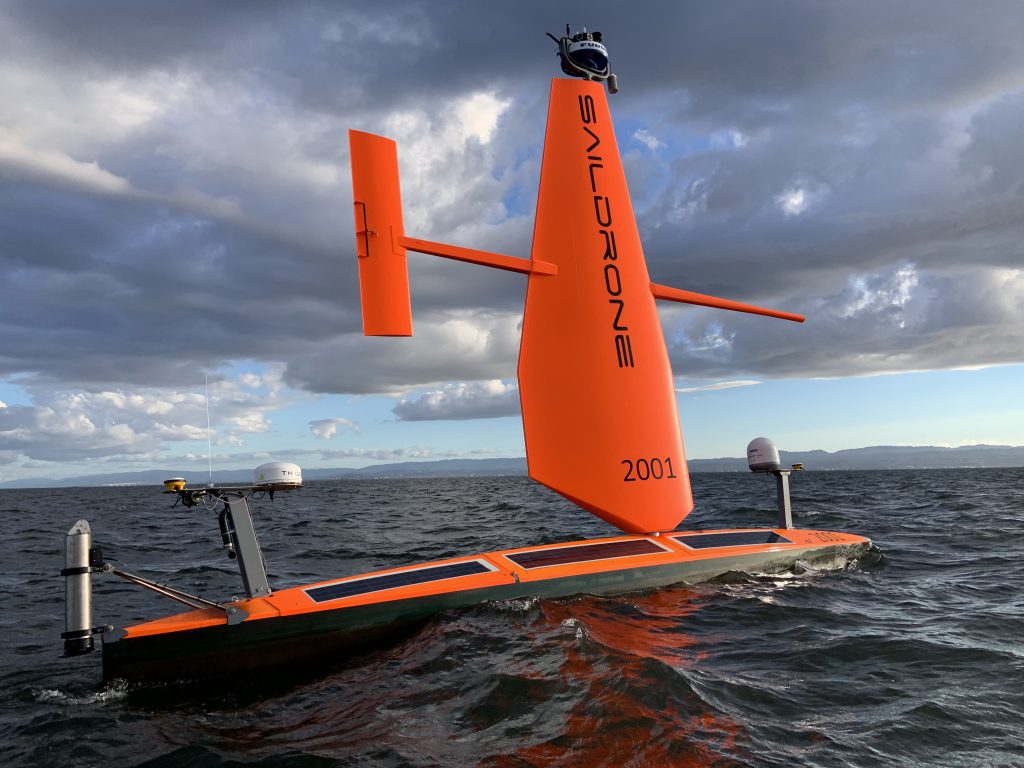
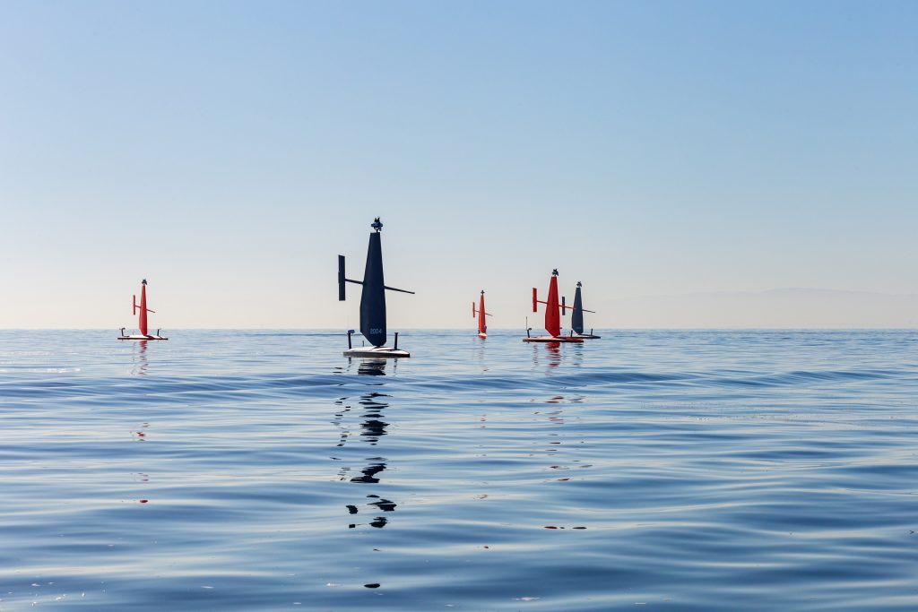
Currently, Saildrone has three platform sizes: the 23-foot Explorer, the 33-foot Voyager, and the 65-foot Surveyor. Jones pointed out all three platforms have various capabilities based on their size.
Company Initiatives
With its autonomous vehicles, Saildrone is able to focus on three main areas: maritime domain awareness, ocean data collection, and ocean mapping.
Maritime domain awareness involves security and defense, according to Jones. It also involves monitoring for illegal fishing, counter drug operations, and human trafficking.
“Our saildrones are basically the eyes and ears on the water to give government agencies and others the ability to keep an eye on remote areas of the ocean where it’s prohibitively expensive to do so with aircraft and conventional ships,” he said. Ocean data collection takes in a myriad of information including oceanographic data and acoustic data, while Saildrone’s third area of expertise involves ocean mapping, which characterizes the sea floor with sonar sensors, according to Jones.
“Offshore wind really transcends all three of those verticals,” he said. “It’s sort of a unique market in that it doesn’t fit any one particular of our business verticals, so it requires expertise and resources from all three areas.”
Offshore wind is going to be an important venture for Saildrone, but it is not the company’s only one, as its three-tiered business model suggests, according to Jones.
“Our vision is for a healthy ocean and a safe, sustainable planet, and what we provide in a carbon-neutral manner has a tremendous impact on humanity,” he said. “Offshore wind is just one of the markets that we focus on, and it’s a big one, but it’s not the only one. We collect a lot of climate data for research purposes and also for hurricane forecasting, for example. There are a wide variety of markets that we service.”
Client Collaboration
Data collection involves a lot of moving parts, both physically and metaphorically, so, to that end, Saildrone is always in search of new methods and techniques to apply its technology, according to Jones.
“Most of the people who work for the company are engineers — hardware, mechanical, electrical — and they come from different backgrounds — Silicon Valley, Tesla, Google, SpaceX, etc.,” he said. “A lot of what we do is we learn from our customers, and we evolve and add new sensors and change the way we do things to adapt to the market. The Lidar that I mentioned earlier used to characterize the wind farms, that’s something that we have done and are in the process of implementing because we realized that it was needed, and there’s a market for it. We listen to the customers in our market and adapt new technologies and new sensors to meet their needs.”
In keeping with that need to adapt and evolve, Saildrone recently launched Voyager, a mid-sized vehicle that will be used to support offshore wind and capable of doing mid-water multi-beam surveys, according to Jones.
“What that means is up to about 300 meters of depth,” he said. “We’re also in the process of integrating a new sonar that will allow us to go deeper. Floating wind has a practical limit of about 1,000 meters of depth, and that’s primarily because of the mooring system. The chain and other things get too heavy beyond about 1,000 meters of length. We’re in the process of integrating a sonar that will allow us to go deeper with the Voyager vehicle to support floating wind, which really is the future of offshore wind.”For the U.S., floating wind will be needed on the West Coast where the shape and characteristics of the coast cause it to get deep very quickly, and on the East Coast, there are plans to implement floating farms beyond the continental shelf, according to Jones.
“That’s some years off, but they do plan on implementing that, but in other places in the world, floating is more common, but it’s still somewhat in its infancy globally,” he said.
Born from a speed record
While offshore wind is expected to be a big part of Saildrone’s business, it has taken 20 years of expertise among various ocean-based projects to build a reputation of excellence, according to Jones.
What eventually became Saildrone began when company founder and CEO Richard Jenkins set out to break a land-speed record in a wind-powered land yacht. It took 10 years with limited resources to perfect his vehicle to break the record, but when he did, he began looking into ways to apply his new-found technology in the commercial world. He found he could apply it to a drone vehicle on the water with a “wing” used to propel the vehicle, much like an airplane wing.
“Over the last 10 years, we’ve been perfecting that, and then, over about four years, we started building larger vehicles,” he said.
And those vehicles are proving to be advantageous to traditional methods in a multitude of ways, according to Jones.
During the COVID-19 pandemic, NOAA was unable to go to sea and do their fisheries surveys on the West Coast because crews could not get to the vessels. People were quarantined, and it was too prohibitive. Jones said Saildrone was able to launch vehicles from San Francisco Bay, conduct fishery surveys, and still allow the fishermen to harvest their fish with an actual increase in their catch limit. The reason for the increase? Because Saildrone’s vehicles were so quiet that they didn’t scare away the fish being surveyed where a traditional vessel’s surveys would be biased by its own noise, chasing away the fish they’re actually trying to quantify.
Saildrone’s USVs have also been instrumental in tracking and gathering hurricane data for NOAA as well, according to Jones.
“2023 will be the third year that we’ve been able to put Explorer vehicles, specially outfitted with a shorter sail, into actual hurricanes to measure the air-sea interaction and collect data to help them understand how these storms intensify,” he said. “NOAA does a pretty good job of track forecasting, but intensity is something that has been challenging for them. We saw that with Katrina. We saw that with many others where they get close to shore and they intensify rapidly and unexpectedly. Folks that made decisions on evacuating based on a forecast are all of a sudden faced with a storm that’s quite a bit more intense than they thought.”
Saildrone’s USVs have been put in the middle of Category 4 hurricanes and have collected data that NOAA has never been able to collect before, according to Jones.
“They have aircraft that go into the storms and they have dropsondes and buoys and different things, but there’s data that we collected that allowed them to measure certain things like salinity that have an effect on sea-surface temperature,” he said. “It’s warmer than they thought, so it gives fuel to the hurricanes, and it might explain some of the rapid intensification that they see. They’ve been able to consider things that they previously could now prior to the data that we collected for them.”
Continued Growth
Saildrone has been quite busy over the last decade proving itself across a wide range of data-collection duties quintessential to all aspects of ocean-related monitoring, but Jones said Saildrone is far from being satisfied.
“Our vision and our goal for offshore wind is to be part of the entire life cycle of the wind farm,” he said.
That includes the four years it takes for the pre-construction survey and monitoring phase and the environmental assessment to construction, and finally the 25-year period where the wind farm operates and generates electricity, according to Jones.
“We anticipate that our vehicles will be part of that entire life cycle,” he said. “During the operation and maintenance phase of the wind farm, we plan on being resident in the field and collecting data about the condition of the export cables and the foundations of the turbines, and also just the general security of the turbines themselves.
Do you have trespassers coming on board and climbing the structures when they’re not supposed to? Things like that. We can keep an eye on everything that’s going on and then let the operators know when it’s time to send a vessel with a crew on it to do repairs or something else that actually needs people.”
And the best part is Saildrone can fulfill those tasks while keeping everything green from start to finish, according to Jones.
“We like to be a part of the ecosystem of developing and operating the wind farm with a low carbon footprint,” he said. “And that’s the philosophy of the company.”
More info www.saildrone.com


