


Autonomous vehicles. High-resolution maps. Weather forecasts. With advances propelling the technology forward over the past couple of decades, Lidar (light detection and ranging) has conquered an increasing amount of applications, radically altering every industry from agriculture to mining to robotics and spaceflight — and wind energy is the latest frontier.
The backbone of remote sensing, Lidar has been used for decades in atmospheric research to determine physical quantities such as gas and aerosol concentrations, temperature, pressure, and humidity. By leveraging pulsed laser light to measure atmospheric constituents such as aerosols, pollutants, and other particles, as well as their dynamics, Lidar has set the remote sensing revolution in motion.
Lidar provides the most quantitative and accurate measurement technique for wind-energy applications. When it comes to remote wind sensing, Lidar is able to measure the full wind regime, characteristics of the wind flow, and things such as windspeed, wind direction, and turbulence — all the way up to 200-plus meters in height when replacing a met mast — or in other instances, as far away as several kilometers.
Evolving Tech Advances the Wind Energy Industry
Today, wind farms are being developed at an ever-increasing rate. Wind-farm real estate in flat, simple environments is being used. Consequently, more complex mountainous and forested terrains and offshore environments stretching farther from coastlines are now being prospected for possible wind-farm opportunities.
At the same time, turbines are growing bigger, reaching higher into the atmosphere, and established technologies, such as met masts, are struggling to keep up. Developers are finding that building, permitting, and installing correspondingly high met masts and instrumentation is becoming increasingly cumbersome, time-intensive, and expensive. In fact, erecting 120-plus-meter met masts is either very complicated or not at all possible in many situations.
Since precise knowledge of the windspeed is necessary to know how much energy will be produced and whether on-site turbines will survive at a specific location, the industry has reached a point in which continuously growing met masts will simply not suffice. As such, evolving remote sensing technologies like Lidar will play a crucial role in the future of wind-farm development.
Advantages of Remote Sensing
Whether developing or operating a wind project, it’s important to understand what the wind is doing — and Lidar empowers wind developers and owner-operators with precisely such data. From the technology’s ease of use and cost efficiency to the time savings, it enables an ability to optimize wind collection; even at the tallest hub heights, Lidar is crucial for wind-resource assessment, power performance verification, and wind farm optimization.
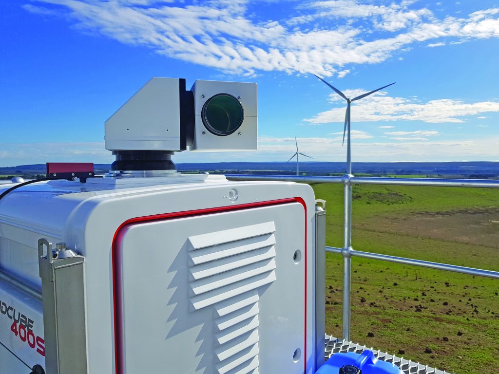
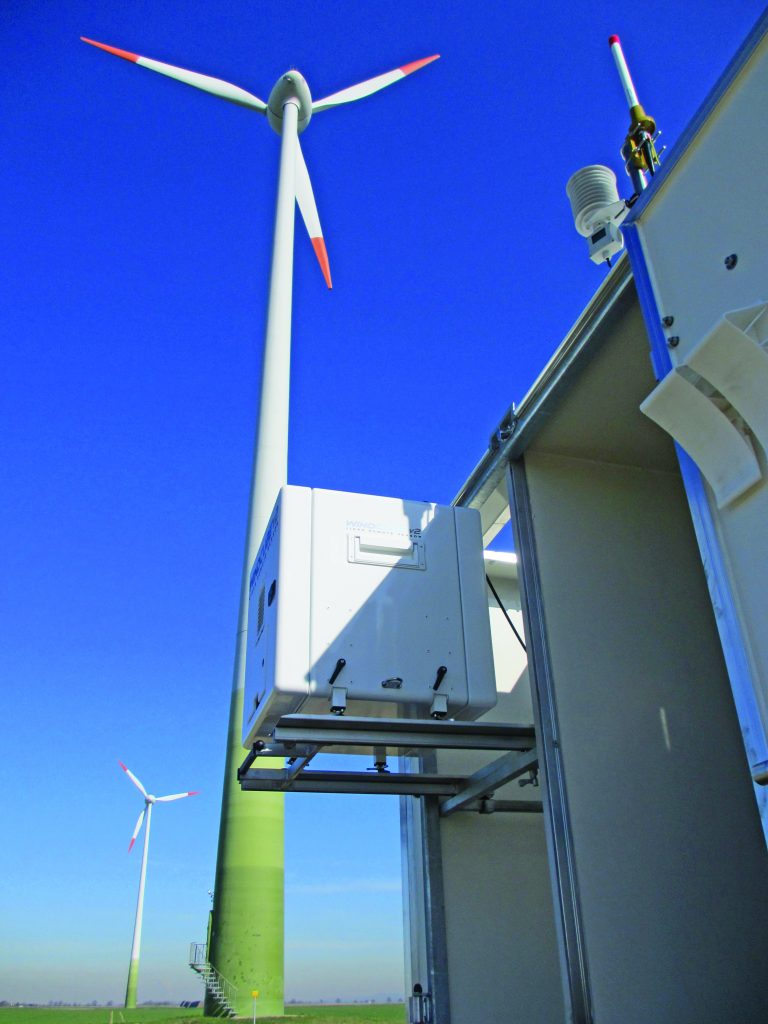
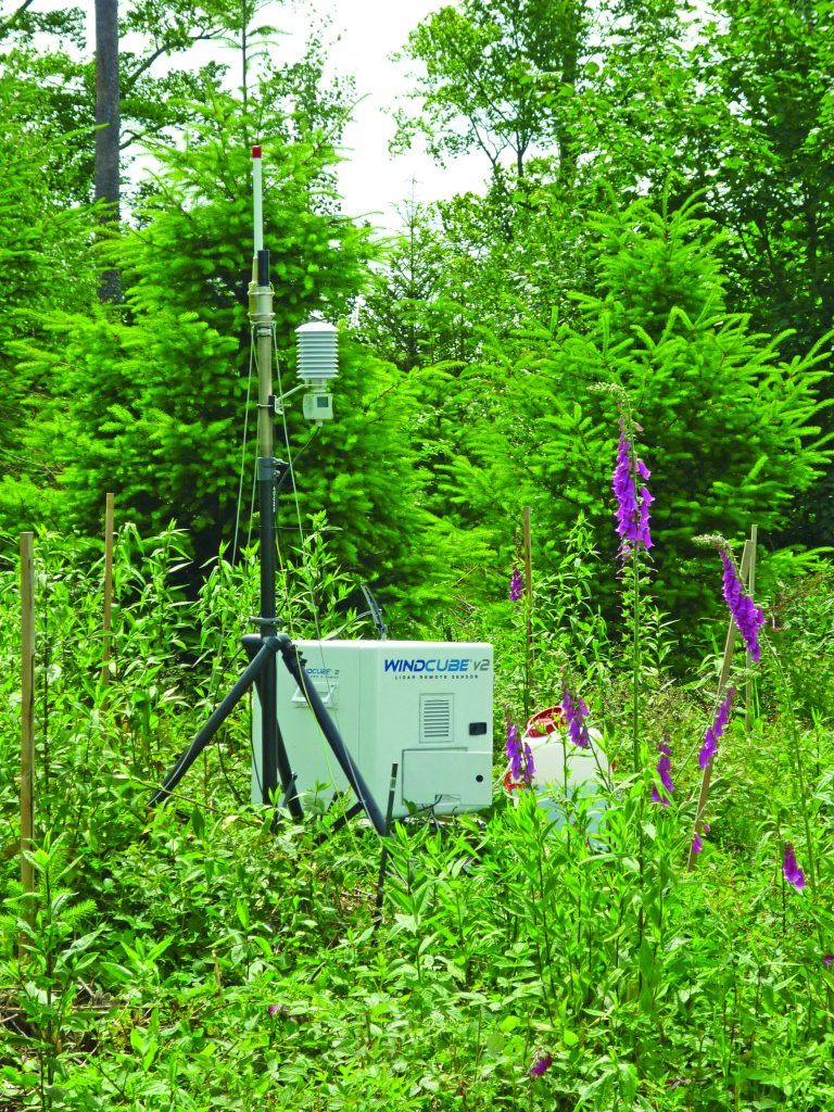
Ease of Use: Lidar technology is remote and portable, and it can be positioned virtually anywhere. Wind sensing Lidars have small footprints and can be easily placed in a broad range of environments, from surroundings involving simple or complex terrain conditions to demanding offshore environments. Once placed, remote sensors are turnkey to use and provide ongoing measurements at multiple heights.
As turbine height grows, met towers are unable to deliver data at such height with reasonable costs and safety conditions. Additionally, as health and safety concerns grow in the industry, annual maintenance work at the top of the met mast is unnecessary when using remote sensing.
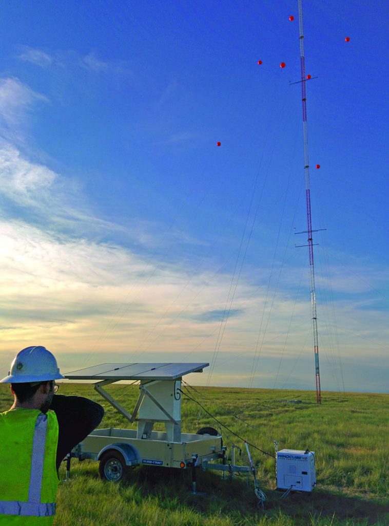
Time Savings: An incredible amount of time goes into wind-farm development before the first turbine starts to produce energy. Once a suitable site is found and agreements are made with owners, the energy-yield assessment can start with at least one year of wind measurement (“wind resource assessment”) as a key input to estimate the production over the lifetime of the wind farm. It can take months to secure permits to install a mast, especially as they grow taller — and during permitting, developers are unable to start measuring, which leads to less data being collected as planning is often time constrained. This leads to higher uncertainties on the energy-yield assessment, which can make or break a project in extreme cases.
With Lidar remote sensors, developers not only shave weeks or months off their development phase and ensure they have all data required, but if they need to move the sensor for additional measurements on the site, they can do so quickly and easily. There’s no permitting required or tower to build. Lidars are mobile, compact, and they deploy in a straightforward and easy manner.
Cost Efficiency: With hub heights above 100 meters and rotor planes now reaching diameters of 130 meters or more on today’s turbines, the wind over the rotor planes will no longer be representatively measured from the single hub height measurement point a met mast delivers. As turbines grow larger, the corresponding masts are becoming prohibitively expensive to install and maintain. In fact, due to Federal Aviation Administration (FAA) regulations regarding mast height, when a mast exceeds 60 meters, the lighting and permitting required significantly increases met tower cost. Additionally, unlike met masts, wind Lidars are able to measure at multiple heights, providing a more robust view of the wind for no additional cost.
Embracing remote sensors will allow for more cost-effective wind prospecting, especially for offshore wind farms and wind farms in complex terrain. In environments with complicated terrain, such as mountains or forests, installing a met mast is either impossible or much more expensive, making Lidar even more cost efficient in those environments.
Lidar also enables enhanced offshore wind resource assessment in harsh offshore environments, where wind farms are currently the fastest-growing energy source in Europe. In fact, according to WindEurope, Europe’s largest organization in the wind industry, Europe can have as much as 450 GW of capacity in offshore wind farms by 2050.
If a developer wants to use a met mast, a multimillion-dollar foundation out in the ocean is required. However, Lidars have the ability to take offshore wind measurements from a vertical profiling Lidar, integrated onto a standalone floating structure, such as a buoy, or placed on offshore platforms. Additionally, scanning Lidar systems enable developers to map the wind from the shore all the way out to up to 15 kilometers, providing enhanced measurements of wind speed and direction. Using Lidar significantly reduces offshore wind-measurement costs.
The more complex the installation — whether due to height, terrain, or location — the more expensive. Fortunately, Lidars can be deployed at a fraction of the price of a met mast to provide trusted data for a broad range of development requirements.
Optimized Wind Collection: Compared to met masts, Lidar allows for accurate and more expansive measurements of the full wind profile in the development phase, helping determine the wind turbines to be selected and how much wind energy a future wind farm would produce. With measurements up to 200-plus meters, systems that use multi-height remote sensing offer full coverage of the rotor, as well as the ability to make finer measurements at many (10 or more) heights, providing a finer understanding of the wind. This understanding, in turn, can lead to uncertainty reduction, which leads to projects that are safer to develop and more lucrative in the end.
Less data means less coverage of wind, which invariably leads to more uncertainty in the final reporting, which could hamper the amount of revenue the wind farm produces. Since Lidar accurately measures up to 200 meters, it supports existing and future wind-farm rotor and turbine heights. Met towers that don’t grow with the turbine height are unable to deliver data with enough accuracy to even attain project funding or maximize the amount of revenue a wind farm produces.
Due to the increased wind complexity in complex terrain, which means increased risk of turbine damage and the need for more security, Lidar enables easier and more precise measurements — at multiple heights — to ensure their quality in complex sites.
Operation, Verification, and Optimization of Wind-Farm Performance: Now, Lidar technology is being mounted on the wind turbine’s nacelle itself to scan in front of the turbine, measuring the wind that will hit the rotor. That way, wind-farm owners can use it as a diagnosis tool to verify and optimize their assets, securing revenue. Many wind-farm operators now use nacelle Lidar to do so during commissioning, where the Lidar is the contractual verification tool included in the turbine supply agreement (already with virtually every new offshore wind farm) or the operational phase of the wind farms. While Electric Power Research Institute (EPRI) data notes a 1 percent annual production increase at a typical wind farm can increase annual revenue by up to $500,000, a theoretically similar decrease in revenue could be assumed as well.
Next-Generation Turbines with Lidar: Lidar can also be installed permanently as a turbine component to improve the reaction to evolving wind conditions and increase in energy production — through better alignment to the wind — and turbine lifespan — by limiting the stress on key components such as gearbox, rotor, or tower. This is done by measuring the oncoming wind in front of the turbine and feeding the turbine controller with this information. This allows the turbine to proactively adjust blades to protect components and increase power. To that end, Goldwind, one of China’s leading wind-turbine manufacturers, recently received the world’s first certification for Lidar-assisted control technology verified to decrease a wind turbine’s load level and stabilize its operation.
As the global demand for energy accelerates, speeding to its fastest pace in more than a decade, wind and other renewable solutions are an increasingly integral piece of the global energy demand puzzle — and Lidar is an essential technology to unlocking the future of the wind-energy industry.
Overcoming Obstacles
As you know, wind-farm development stakeholders can be rather risk-averse. Consequently, many take a cautious approach when it comes to embracing change. From formal industry standards to reluctance on the part(s) of financiers and bank engineers, the predominant obstacles impeding mainstream adoption come down to the devil we know vs. the one we don’t.
Although formalized International Electrotechnical Commission (IEC) requirements for using ground-based remote sensing for power curve measurement have existed since 2017 (IEC 61400-12-1 ed2), the wind-energy industry is still in the process of creating an IEC standard for the use of ground-based Lidar for wind-resource assessment (IEC 61400-15).
Another standard (IEC 61400-50-3) for nacelle-mounted Lidar power curve measurement is set for the not-too-distant future, with planned releases in 2021 and 2020, respectively.
Plus, many leading independent bank engineers already are familiar with remote sensing as it’s been used in Europe for years, and several international and national guidelines are already being used. Some have even written specific guidelines to address the lack of IEC standards. With increased adoption, more financiers and bank engineers will seek to understand the requirements for using Lidar in a bankable wind-resource assessment measurement campaign.
With 50 years of met tower data — good or bad — the industry feels like they know what to expect, while remote sensing is relatively new and unknown. But even as the technology and standards for its use evolve, the past decade has seen companies financing wind farms using Lidar.
While the first commercial Lidar products for meteorological, aviation, and wind-energy-related applications only reached the market two decades ago, Lidar matured very quickly. As the technology continues to advance, the revolutionary sensing technology will only find additional applications as it permeates new industries and continues to provide more accurate and more robust data. Clearly, remote sensing using Lidar has become a proven technology that allows for more accurate and expansive measurements of wind during the development, verification of performance, and ongoing optimization phases of a wind-farm project.


