The advanced wind-measurement capabilities of Lidar have unleashed tremendous opportunities for the offshore wind industry. After years of successful validation campaigns, offshore professionals are now favoring Lidar over met masts for wind-resource assessment, power-performance verification and wind-farm optimization.
Gathered at a Lidar User Seminar hosted by Leosphere at the Offshore Wind Conference 2017, leading wind-measurement experts from Deutsche WindGuard, ECN, EDF EN, MHI Vestas Offshore Wind, RES, Siemens, SSE, and UL DEWI shared their experiences of using Lidar technology for a broad range of offshore applications. In this paper, we draw on the industry’s practical experience to offer a unique Lidar user perspective on the role of this technology in the rapidly evolving offshore market.
From R&D to Commercialization
The wind industry has resolutely stepped forward into a new era of adopting Lidar technologies in commercial projects. Multiple deployments in significant offshore wind farms have effectively set the stage for their widespread use and expected primacy over traditional measurement technologies.
After more than a decade of successful validation campaigns performed throughout the world, Lidar technology has secured a high level of confidence among wind-power experts who recognize its technological maturity and reliability for effective commercialization in offshore as well as onshore projects in simple or moderately complex terrain conditions. Lidar is now accepted as a proven technology by the wind industry from a practical, contractual and, increasingly, from an industry standards’ perspective.

Offshore, Lidar is completely replacing met masts, enabling significant project development and operational cost reductions. It has been instrumental in addressing the critical installation, cost reduction, and safety challenges associated with offshore mast installations. Thanks to those advantages, Lidar is emerging as the main wind-measurement technology used by industry professionals for offshore wind resource assessment as well as plant optimization purposes. Lidars offer a broad range of benefits that add considerable value to projects. They are a cost-effective solution to deliver accurate and reliable measurements quickly, enabling users to save precious time on their campaign, and providing them with the bankable data they need. They are easy to install, require little maintenance and are extremely competitive on cost.
Over the last decade, the practices of major turbine suppliers such as Siemens Gamesa have evolved to include the use of Lidar for an increasingly broad range of applications. The ground-based Windcube has been deployed for wind resource assessment, prototype power curve validation, or site calibration, whereas the nacelle-mounted Wind Iris has been used for wind-turbine performance monitoring or prototype and warranty power curve assessments. But these are just the most commonly used applications. As these practices are becoming mainstream, other high-potential Lidar applications such as site calibration after turbine erection or turbine control also are being actively developed and implemented.
Securing bankable data
Precise and reliable wind resource measurements are critical for developers to increase project value. These measurements provide the essential data used to calculate the potential energy yield from a project, which in turns dictates the terms of the project financing.
Just a few years ago, met masts were still the only bankable wind-measurement tool available to the industry at the project-development stage. This is no longer the case. In the challenging offshore environment, standalone Lidars are extensively used to provide trusted data for a broad range of development requirements. These include better estimation and comprehension of the meteorological conditions across the offshore area, preliminary estimations of the AEP, and preliminary site condition assessments.
As always in the offshore industry, cost plays a critical role. Lidars can be deployed at a fraction of the price of a met mast, whose installation can cost more than 10 million euros, an investment that largely exceeds today’s average development budget. Several offshore projects have secured financial closing using Lidar-based energy yield assessments alone.

(Courtesy: Leosphere)
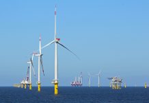
Recent examples include the Beatrice offshore wind farm, a £2.6 billion, 588-MW project developed by Beatrice Offshore Windfarm Ltd in Scotland, or the 500 MW St-Brieuc Offshore Wind Project in France developed by RES and Iberdrola. For St-Brieuc or Beatrice, the use of stand-alone Lidars has led to multi-million euro savings compared to the cost of installing a met mast, while delivering the essential bankable data needed for these multi-billion offshore projects.
In the Netherlands, ECN has deployed the standalone Windcube in its measurement network to provide bankable data to support the Dutch government’s ambitious offshore wind installation targets. Depending on the specific project conditions and location, different types of Lidar technologies and setups are available to deliver accurate meteorological condition measurements for robust project development. Scanning Lidars such as the Windcube 100S/200S/400S are used for mapping the wind from the shore at up to 10 kilometers. They can perform a full 3D mapping of the atmosphere to provide enhanced measurements of wind speed and direction.
In January 2016, The Offshore Wind Accelerator program (OWA) launched the world’s largest offshore trial of scanning Lidar systems. The four-month trial showed phenomenal accuracy at long ranges, as well as uncertainty reductions of the P90/P50 ratio by between 1 percent to 2 percent, therefore proving the technology’s ability to significantly lower the LCOE offshore.
The appropriate deployment and siting of Lidars will vary depending on the distance of the site from the shore, and its specific configuration. For wind farms located far offshore, the Windcube enables the accurate measurement of wind on stable offshore platforms, as demonstrated at the St-Brieuc and Beatrice projects. When platforms are not available or cannot be built, floating Lidars installed on a buoy are the most effective wind resource assessment tools.

In 2013, floating Lidars were tested and validated as part of the U.K.’s Carbon Trust Offshore Wind Accelerator program. Because of the current absence of normative standards defining how a floating Lidar should be deployed, the OWA has published a set of recommendations to give the industry the formal framework it needs to accelerate the commercial deployment of the technology while standards are being developed.
In 2015, EDF EN performed a four-month validation campaign of the floating Lidar in compliance with the Carbon Trust recommendations at the Fécamp platform, where a met mast and a Windcube were installed. Following this test campaign, they found an uncertainty coefficient of less than 4 percent, lower than the Carbon Trust’s uncertainty recommendations (4 percent to 7 percent). EDF EN also pointed out that an important part of the floating Lidar uncertainties were actually due to the reference uncertainties. There is a strong consensus in the industry that floating Lidar is an effective and reliable technology, and developers such as EDF EN are hard at work to swiftly bring floating Lidar to a commercial deployment stage.
Improving asset performance
For operational wind farms, Lidars are used to monitor turbine performance and optimize the project. Thanks to their ability to measure, log, and characterize the approaching wind across the entire rotor span, in addition to measuring at hub height, they are key to improving energy production as well as the operator’s understanding of its asset performance. They are used for several applications including power-curve measurements, yaw error correction, and wind sector management.
Nacelle-Lidars such as the Wind Iris are firmly established as a powerful tool for contractual power curve testing. They provide a precise evaluation of the correlation between the measured wind speed and the turbine output, which is essential to verify the turbine’s performance against the warranted contractual power curve. Although nacelle-Lidar measurements are not yet covered by IEC standards, developers are requesting that nacelle-mounted LIDARs be selected as a cost-effective alternative to met masts as part of the Turbine Supply Agreement.

According to Deutsche WindGuard, demands for the inclusion of nacelle-mounted Lidar for power curve test in turbine agreements occur in about half of the projects. Since 2013, the German independent consulting firm highlighted that power curve warranties based on two- and four-beam nacelle Lidar power curve verification already have been successfully created by three of the leading turbine suppliers.
For offshore wind farms, delivering contractual power curve verification tests according to IEC 61400-1-12 standards remains highly impractical. Indeed, the standards implicitly require the installation of a met mast, a costly option that, in addition, allows for the testing of only one turbine. On the other hand, nacelle-Lidar can deliver accurate measurements for multiple turbines with high availability and low uncertainties.
Nacelle-Lidar measurements are now a method accepted by all established turbine manufacturers for verifying warranted power curves offshore. In addition, scanning Lidars also generate strong confidence among users. Both technologies have been proven to deliver accurate power curve measurements, as demonstrated at the Greater Gabbard 504 MW offshore wind farm developed by SSE and RWE Innogy. For this project built 23 kilometers off the coast of Suffolk in England, a Wind Iris was installed on a nacelle. The setup was completed with a scanning Lidar, which was installed on a transition piece of a turbine. This power curve verification campaign demonstrated that Lidar-based power curve testing was as accurate as mast-based campaigns. Similar conclusions were reached in a campaign developed by
Deutsche WindGuard, which showed excellent agreement between the power curve measurements performed with the nacelle-Lidar and scanning Lidar for the same turbine and measurement period. The high correlation of the results, obtained with two entirely different and independent Lidar systems, are confirming the strong capabilities of each technology.
Deutsche WindGuard’s validation campaigns showed the Lidar-based power curve test’s total uncertainty is similar to best practice cup anemometry. This is true both offshore and onshore in simple terrain, two contexts in which Lidar technology is anticipated to be included in projects as a matter of course.
What is more, nacelle-Lidars become increasingly relevant as the power ratings and rotor diameters of offshore wind turbines keep growing. This is because they can measure horizontal wind speed at a significant distance from the rotor plane. It is, for example, the MHI Vestas Offshore Wind ESTAS V-164 8.0MW, which sports a 164-meter rotor diameter, requires the use of a system that can measure out at a distance of minimum 410 meters. Although the Wind Iris is specified up to 450 meters, such distances are beyond the scope of most other devices on the market.
In 2015, MHI Vestas Offshore Wind ran a power-curve verification test campaign at the Østerild site to collect the data and experience needed for the preparation of their commercial offering. The campaign concluded that the Wind Iris nacelle-Lidar was able to measure wind speed out to 454 meters, with a precision similar to that of a met mast. In response to customer request, the Danish manufacturer went on to develop a nacelle-based power curve verification method based on the Wind Iris 2-beam for large rotors, which was independently reviewed by DTU Wind Energy. The procedure is easily applicable for the Wind Iris 4-beam as well.
Eventually, nacelle-Lidar power curve verifications are expected to be generalized on all operating wind farms to improve the understanding of potential turbine underperformances globally. Siemens is at the forefront of that trend. This leading offshore player is already including the bracket design for nacelle-Lidar on the turbines design specifications, which enables the company to offer the Wind Iris as an option in its standard turbine contracts as well as optimize Lidar siting. At the same time, they are developing a nacelle-Lidar power curve verification method based on the Wind Iris 4-beam device. From a developer’s perspective, the result of these power-curve measurements can be used to negotiate the contractual warranty level and to adapt losses applied on annual energy assessments.
Future challenges
Today, Lidars have moved from the margin to the mainstream. They are set to replace met masts entirely for offshore applications and to be systematically used in wind farms at one or multiple stages of their life cycle. They already are recognized by the wind-measurement community as truly operational, maintainable, and reliable tools to deliver bankable results for offshore and onshore wind-feasibility studies and warranted power-curve verification tests. For these applications, they will most likely be deployed universally in the short term. At the same time, the industry is working hard to adapt IEC Standards and speed up the deployment of Lidars for commercial projects. However, the industry is far from done exploiting the full range of capabilities offered by Lidar. This versatile technology also continues to be developed and validated for a broad range of other critical applications. Indeed, Lidars already have displayed great potential to help improve turbine control and load management, wake-effect measurements, wind-sector management, site calibration, and power forecasting.
As vertical wind profiler and nacelle-Lidars already have achieved widespread industry acceptance and effective commercial deployment, scanning and floating Lidars have rapidly been building their own track record in offshore wind. Industry specialists expect them to quickly become a prominent technology with the required maturity for large-scale commercialization.


